Kachemak Bay Watershed Collaborative

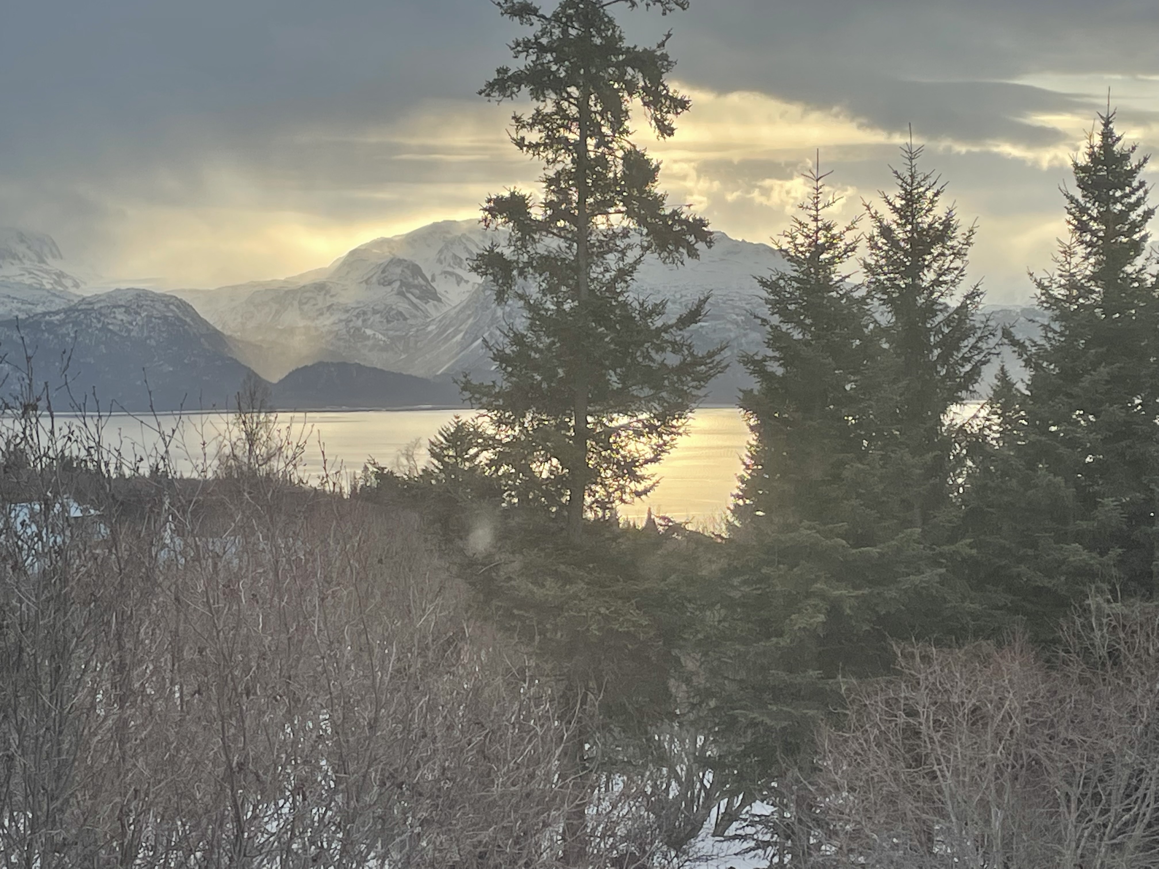
Kenia Mountain Range & Kachemak Bay


The Chugach Regional Resource Commission (CRRC) is an Alaska Native Tribal consortium in south-central Alaska whose Dena’ina, Alutiiq, and Sugpiaq villages and association members have stewarded of the Kachemak Bay watershed for over 10,000 years. CRRC’s mission is to promote Tribal sovereignty and protect subsistence lifestyles through the development and implementation of Tribal natural resource management programs to assure conservation and sustainable economic development in the traditional use area of the Chugach Region.
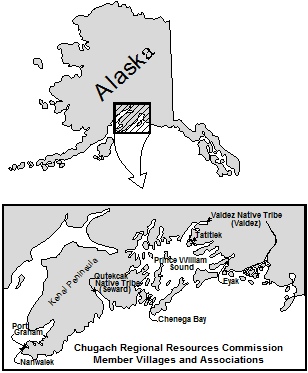
CRRC Tribes Map

CRRC serves the greater Chugach region of Southcentral Alaska, including Lower Cook Inlet, Resurrection Bay, and Prince William Sound. Within Lower Cook Inlet CRRC will work with area member tribes to establish the Kachemak Bay Watershed Collaborative (Collaborative or KBWC) to protect salmon streams located within the Kachemak Bay Watershed (Watershed). The Athabascan and Sugpiaq communities located within the Watershed rely on a subsistence economy, as they have since time immemorial.

CRRC will engage a diverse group of stakeholders with land ownership or authority within the Watershed, including Federally recognized Tribal entities, the U.S. Fish and Wildlife Service, the Alaska Departments of Natural Resources and Fish and Game, the municipalities of Homer, Kachemak Selo, Voznesenka and Razdolna, Seldovia and the unincorporated Native village communities of Nanwalek and Port Graham, and conservation organizations.

Many changes related to warming fresh and marine water temperatures impact the subsistence resources. Increasingly common drought conditions and spruce beetle outbreaks in the region threaten the health of the plants and animals rural communities rely upon for subsistence. These changes are happening at a rate no one thought possible even a decade ago. Land management activity within the Watershed can exacerbate such impacts. The Collaborative will work to be more inclusive of tribal and other local communities along with local, state, and federal stakeholders in monitoring, planning, and decision-making within the Watershed. The implementation of risk assessments and planning documents, along with preserving connectivity and non-climate stressor mitigation actions, will ensure better protection and management of salmon habitat in the Watershed.

Project location 

The 4,926,794-acre Watershed is made up of five small watersheds located in the Kenai Peninsula Borough within the state of Alaska and encompasses the municipalities of Homer, Kachemak Selo, Voznesenka, Razdolna, Seldovia, and the unincorporated Alaska Native village communities of Nanwalek and Port Graham. The United States Geological Survey (USGS) Hydrologic Unit Codes (HUC) in which the group will work are: Cook Inlet, Stariski Creek-Frontal Cook Inlet, Fox River, Sheep Creek and Quiet Creek-Frontal Kachemak Bay Watershed HUC ID #s: 1902080000, 1902030108, 1902030110, 1902030109 and 1902030111 respectively.

Technical project description 

There is currently is no group focused specifically on this Watershed, although a diverse array of stakeholders, including livestock grazers, tourist and recreation groups, industry, environmental organizations, recreation advocates, universities, land use, tribal, state and federal entities, municipalities and the general public utilize the area. This Watershed group will also help fill a planning gap left by the elimination of Alaska’s Coastal Zone Management program.

There are several ongoing or previous watershed planning activities, projects, or efforts related to the Watershed that the Collaborative will build upon, including:

  • The Kachemak Bay Fox-River Climate Risk Assessment analyzes current threats to salmon habitat within a portion of the Watershed, addresses salmon habitat connectivity and climate resiliency for the entire Watershed, and works with federal and state resource agencies to enter into cooperative agreements for management of salmon habitat on a watershed basis;
  • The Alaska Department of Fish and Game Fox River Flats Critical Habitat Area (FRFCHA) management plan addresses regulatory management goals for the FRFCHA and includes managing the area to 1) maintain and enhance fish and wildlife populations and their habitat; 2) minimize the degradation and loss of habitat values due to fragmentation, and; 3) recognize cumulative impacts when considering effects of small incremental developments and action affecting critical habitat resources.
  • The Kachemak Heritage Land Trust’s (KHLT) Krishna Venta Conservation Management Plan addresses working collaboratively with state, federal, and local entities as KHLT purchases and negotiates conservation easements on private lands for the purposes of management and protection of fish and wildlife habitat of KHLT’s 160 acres in the FRFCHA;
  • The Kenai Mountains To Sea – Land Conservation Strategy to Sustain Our Way of Life on the Kenai Peninsula calls for the creation of contiguous “green” corridors along 20 inter-jurisdictional anadromous streams, most of which originate on the Kenai Refuge. Such protection will increase the resiliency of these streams and the marine habitat into which they feed from the effects of a rapidly warming climate while ensuring that large piscivores such as brown bears and wolves persist to transport marine derived nutrients onto the landscape;
  • The Department of Natural Resources’ Kachemak Bay State Park and Kachemak Bay State Wilderness Park Management Plan addresses management of the 371,000- acre Kachemak Bay State Park and Kachemak Bay State Wilderness Park (State Park);
  • The Cook Inlet Keeper State of the Inlet watershed restoration plan within the Watershed captures threats and community-specific concerns and ideas to help direct CIK’s watershed-based organization as the plan future projects.

Join the Collaborative:

If you are a federal, state, or tribal entity, conservation group, or anyone else interested in the welfare and sustainability of Kachemak Bay, please join our Collaborative. If you have any questions please contact Hal Shepherd halshepherdwpc@gmail.com

Last Stand for the Tongass

The Tongass National Forest, the largest national forest in the United States, is a landscape comprised of old-growth Sitka spruce, western hemlock, and red and yellow cedar. These mighty trees, along with innumerable glacially-fed streams and lakes, give rise to all five species of Pacific salmon, humpback whales, healthy black and brown bear populations, wolves, and omnipresent bald eagles. Located in southeastern Alaska, the 17 million acre Tongass is the size of West Virginia and home to 70,000 people, including the First Nation people of the Tlingit, Haida, and Tsimshian, and the city of Juneau, Alaska’s state capital. It is also the largest expanse of roadless wilderness in the national forest system, at least for now.

Protected by the 2001 Roadless Area Conservation Rule (signed into effect by President Bill Clinton), 55% of the Tongass, or 9.2 million acres, is off limits to road construction and timber sales.  But, in January 2018, under Governor Bill Walker’s administration and with the backing of the Trump Administration, the State of Alaska petitioned the Secretary of Agriculture to consider exempting the Tongass from the Roadless Rule.

Under the federal National Environmental Policy Act, any consideration to exempt the Tongass from the Roadless Rule requires a 60-day public comment period and a scientific analysis of environmental impacts to the Tongas. The 60-day public comment period, conducted this summer, fell well short of its obligation according to tribal members who received last-minute notice of public meetings. In their opinion, the comment period “exemplifies the federal government’s long-running failure to adequately work with tribes.” In response, eleven southeast Alaskan tribes vested in the outcome of the upcoming ruling, filed a petition in July, requesting the USDA consult with tribes “on a government-to-government basis.” Earlier attempts by area tribes to engage in the two-year process were derailed because “the USDA repeatedly ignored their input and requests for in-person meetings; fast-traced seemingly arbitrary deadlines; and proceeded as usual despite a pandemic that has disproportionally hurt Native communities.”

The Final Environmental Impact Statement (EIS), was released on September 24, 2020 and analyzes six alternatives, including a no-action alternative. Trump-appointed USDA Secretary Sonny Perdue prefers Alternative 6 which “provides maximum additional timber harvest opportunities,” removing “all 9.37 million inventoried roadless acres on the Tongass from roadless designation.” Moreover, “Alternative 6 would revert a net total of 168,000 old growth-acres and 20,000 young-growth acres, previously identified as unsuitable timber lands, to suitable timber lands”. The Tongas will “continue to be managed by the Forest Plan and in accordance with applicable statutory instructions.” There is a 30-day waiting period following the release of the EIS prior to implementation to allow for review.

If you want to weigh in against opening up the Tongas, please see the following websites.

https://addup.sierraclub.org/campaigns/keep-alaskas-tongass-national-forest-roadless

https://act.nrdc.org/letter/tongass-forest-181004

Your voice matters.

Trump Puts the Pause on Pebble Mine

Brown Bear Cub
Lake Clark National Park

A reprieve in the contentious Pebble Mine project came from an unlikely source, when President Trump paused the permitting process for the gold, copper, and molybdenum mine in Southwestern Alaska after previously backing the project.  Located in the headwaters of the lucrative Bristol Bay sockeye salmon fishery, the project is slated to include the largest earthen dam ever built, despite being located in a seismically active region. The 20 square-mile pit mine would require roads and a gas pipeline through pristine wilderness near Lake Iliamna and Lake Clark. Brown bears, wolves, moose, caribou, waterfowl, and all five species of Pacific salmon, along with some 7,500 people, mostly traditional Natives, live in the region likely to be most impacted by the mine.

Trump is calling for additional information from the Pebble Limited Partnership about environmental mitigation from the degradation caused by the project. In a letter to the Partnership, the Corps listed new requirements that would need to occur in order to mitigate the impacts of Pebble to the Bristol Bay ecosystem including compensation for impacts on 2,825 acres of open water and 129.5 stream miles within the Koktuli River watershed and on 460 acres of wetlands, 231 acres of open water and 55 stream miles along the transportation corridor and port sites. The agency gave the partnership 90 days to update their plan to address these impacts. This sudden about-face appears to have been prompted by statements made by Trumps eldest son, an avid fisherman who has fished in the region, as well as other influential Republicans who have Trumps ear.

Read more.

New Global Database Spotlights Freshwater Fish and Climate Change

Research findings on inland fish and impacts from climate change are now available in an updatable, searchable database, thanks to a team effort by the National CASC, USGS, and University partners. FiCli (the Fish and Climate Change Database) contains a breadth of peer-reviewed literature spanning geographic regions on a global scale. The data, which will continue to grow as more data are added, will help inform resource managers and spur future studies on fish health and climate.

USDA Forest Service Updated “Forests to Faucets” Data released

Forests to Faucets premiered in 2011 to portray the relationship between forests and source water across the U.S. The updated version 2.0 (F2F2) dataset released in April assesses all 88,000 HUC12 watersheds in the U.S. to identify those forests important to downstream surface drinking water supplies and evaluate each watershed’s natural ability to produce clean water. F2F2 includes future risks to watersheds such as development, wildfire or climate-induced changes to water quantity. More information available, here.